Land Surveying Takes to the Skies with Drones
February 23, 2026
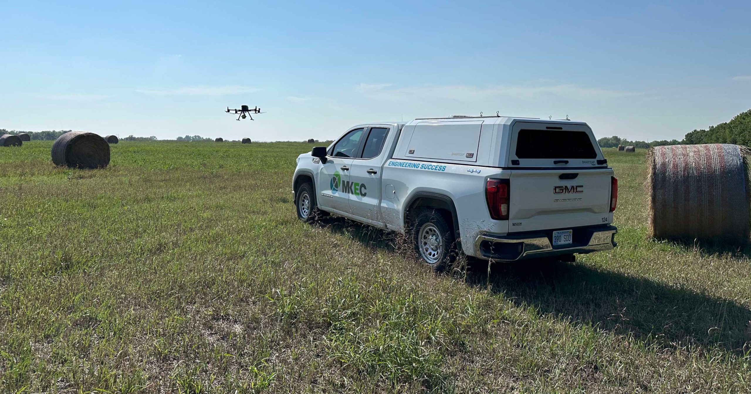
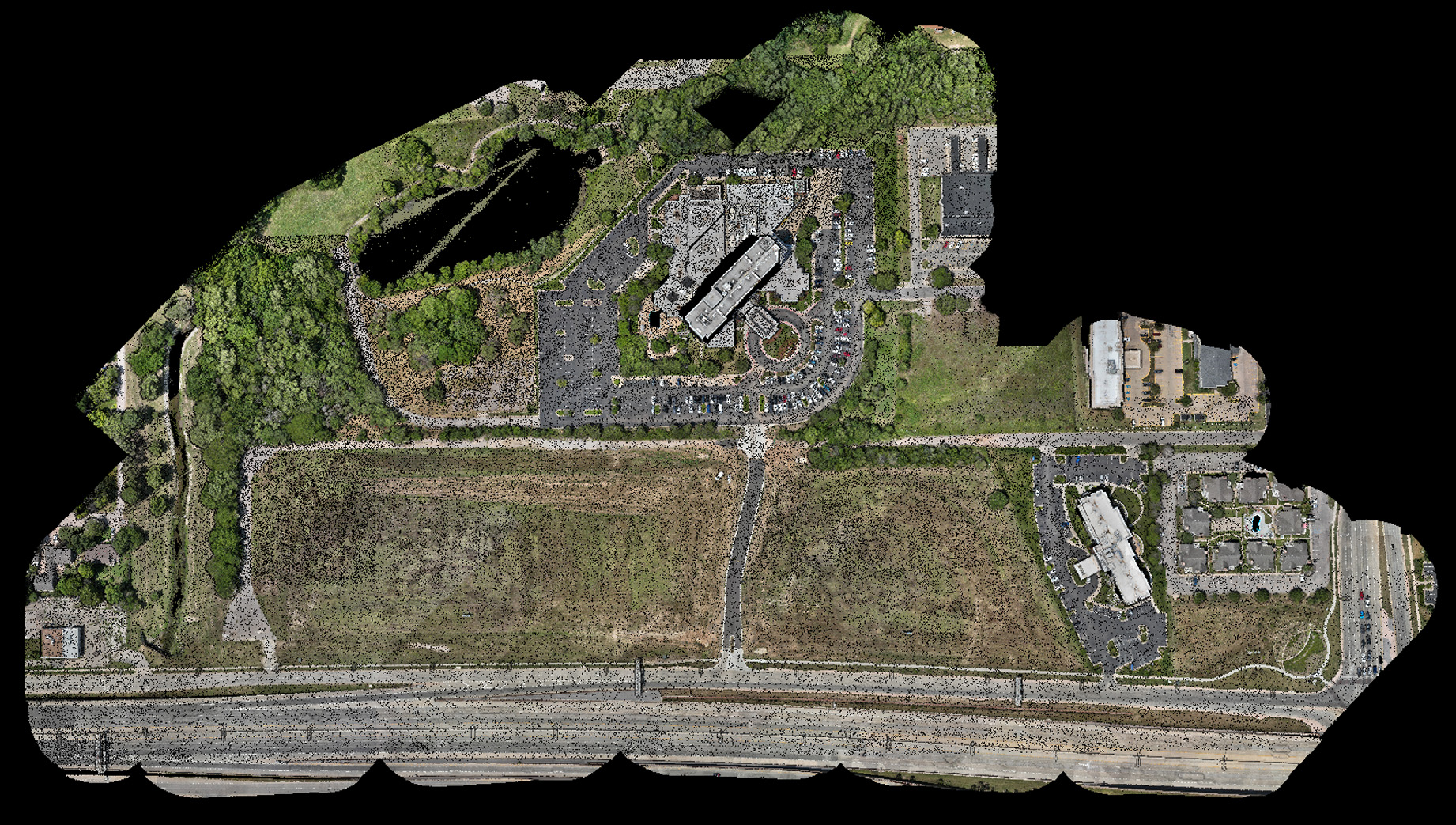
It seems like drones are everywhere. Amazon keeps promising us drone delivery. Fireworks shows are being replaced by drone shows. Drones are being used for security and safety purposes. So it’s no surprise that drones have become a useful tool in the engineering toolbox, especially when it comes to surveying.
“We use drones to supplement personnel and staffing,” said Michael Small, who has more than two decades of experience in MKEC’s surveying department. “It’s just another tool in the toolbox. We can collect a large amount of data in a short amount of time, but it’s a tradeoff of field time versus office time. It can cut down the field time dramatically, which helps with crew schedules. However, drone data takes longer to process in the office than traditional survey data, so scheduling the mapping of the data is also a consideration of use on a project.”
Drone decision-making
While drones can speed up time in the field, not every project is a good fit for using our Unmanned Aerial System (UAS).
“We look at each project individually on whether it makes sense to use it or not,” Small said. “Wichita is the air capital of the world, so there’s the added challenge of restricted airspace everywhere. You are required to obtain FAA variances to fly in restricted airspace.”
The process of getting an FAA variance can sometimes be lengthy, which may mean it makes more sense to use traditional surveying techniques to get the job done. Weather conditions are also a factor.
“The wind is one aspect to think about,” Small said. “Our aircraft is rated to fly in a limited amount of wind. In addition, sunshine is actually a detriment to aerial photography due to the shadows it can cause. The ideal weather is overcast conditions with no more than a 10-15 MPH wind. If ideal conditions can’t be met, we can re-schedule or pivot back to more traditional survey methods. Checking the weather is a key element of the decision-making process.”
But if the weather and airspace restrictions allow, drones can cut down on the time it takes to complete an on-site survey.
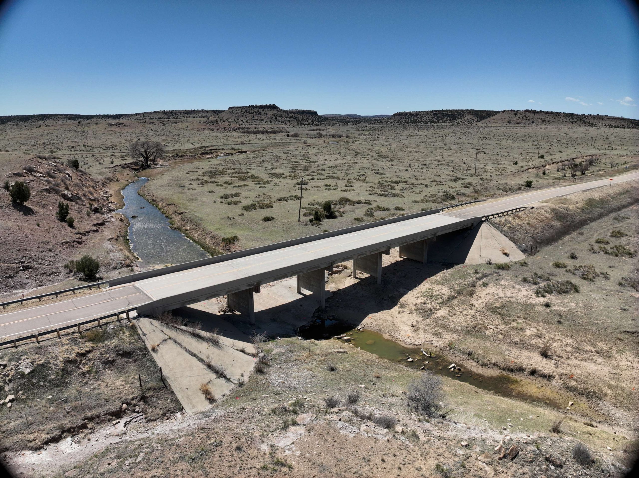
“We used drones on one of our DOT projects,” Small said. “We were able to fly the project in less than two days where with a traditional survey, it would have been about a two-week survey.”
Small has also used drones to map spaces that are difficult to see.
“We’ve started using drones in new ways,” he said. “We had a situation inside of one of our refineries where we had a nozzle on top of a tall vessel that could not be seen from any platform or the ground. Traditional laser scanner couldn’t see it. We were able to use the drone to collect that data so our design team could model it.”

Precision and accuracy
While processing the data gathered from a drone survey may take longer, Small appreciates the pinpoint accuracy of the results.
“The available data that we get can be more accurate than traditional surveying just because the sample set is so much larger,” Small said. “It’s a better way to provide a more accurate survey.”
But drones won’t make traditional surveyors obsolete.
“Is that going to replace boots on the ground surveyors?” Small said. “Absolutely not. For every drone project, we use traditional surveying techniques to collect an independent data set to compare and validate the processed drone data. We do a statistical test to make sure the data is good and meets our mapping standards. We still need surveyors in the field to establish the control that ties down the aerial data and gives it its survey-grade accuracy.”
Like all professions, surveying has gone through a variety of changes since some of the first surveyors laid out the Egyptian pyramids.
“The science and math haven’t changed,” Small said. “It’s just that the method of how we accomplish those measurements has evolved into what we have today. Back in the 1860s, they used 12-man survey crews. Today it’s a one-man survey crew. The nuts and the bolts of it is: science is science, math is math. Drones just offer a better, faster, and more precise way to apply those principles of collecting the data.”
But surveyors are still essential to the process.
“Anybody can buy a drone, and anybody can put it up in the air,” Small said. “You can collect the data, throw it in a piece of software, and spit out a surface. However, the difference comes in when a trained surveyor can look at the information collected and identify the correct placement of features and breaklines that will create a product that accurately represents real-world conditions. The surveyor’s experience is essential to making sure that we are getting the correct answers from whatever technology is being utilized. Our goal as surveyors and mapping technicians is to protect the public by using our knowledge to make sure the data we’re providing is accurate.”

“Our goal as surveyors and mapping technicians is to protect the public by using our knowledge to make sure the data we’re providing is accurate.”
Michael Small, Land Surveyor, Survey Department Manager